



BNPB reports floods and fires across Indonesia
JAKARTA, thekabarnews.com—Flooding forced at least 672 people from their homes in Padang as landslides blocked strategic roads in Aceh and forest fires burned around 63 hectares in Merauke, according...

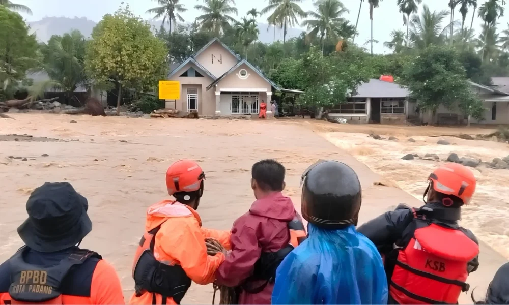
JAKARTA, thekabarnews.com—Flooding forced at least 672 people from their homes in Padang as landslides blocked strategic roads in Aceh and forest fires burned around 63 hectares in Merauke, according to a nationwide disaster update issued by the National Disaster Mitigation Agency (BNPB) on Sunday, Oct. 11.
The report, covering developments through 7 a.m. WIB, showed emergency teams working across Aceh, West Sumatra and South Papua. Officials cautioned that casualty, damage and displacement figures remained provisional as field assessments continued.
In Padang, West Sumatra, heavy rain on Saturday inundated six urban villages across the Kuranji, Koto Tangah and Nanggalo districts. BNPB recorded about 225 families, comprising 498 people, as affected. Separate preliminary data placed 672 evacuees at shelters and residents’ homes in Kuranji.
The different totals came from assessments that were still being reconciled. Search-and-rescue teams had evacuated 238 residents by early Sunday.
BNPB reported one severely damaged house and four with moderate damage. About 120 homes were affected, while flooding severed a road near the municipal water utility facility in the Guo area.
The Meteorology, Climatology and Geophysics Agency (BMKG) had warned of moderate to heavy rain in West Sumatra on Oct. 10. Its early-October high-rain advisory also placed Padang under an alert category, supporting calls for continued vigilance. BMKG’s weekly outlook identified rain potential in West Sumatra and Aceh between Oct. 9 and 11.
In Aceh, floods and landslides struck Gayo Lues and Aceh Tenggara after prolonged heavy rain on Friday. A landslide completely closed the Blangkejeren–Takengon national road in Gayo Lues. The disaster damaged one house and a bridge, while officials continued assessing damage to farmland and three road connections.
Landslide debris also blocked the Kutacane–Blangkejeren road in Aceh Tenggara. The disaster breached an embankment and swept away the intake structure serving the Lawe Harum drinking-water system.
Read also: Aceh police arrested a TikTok user over alleged blasphemy and hate speech in Bengkayang
Floodwaters in both regencies had receded by Saturday, but excavators and joint emergency teams continued clearing landslide debris. BNPB’s updated disaster-risk index classifies Aceh Tenggara as a high-risk regency and Gayo Lues as medium risk. BNPB updated its disaster-risk index on Oct. 10.
Meanwhile, forest and land fires (karhutla) spread across 10 districts in Merauke, South Papua. Authorities measured about 63 hectares of burned land across nine locations, while the affected area in Kondo village remained under assessment.
Crews had extinguished fires at four locations and started cooling operations. Several other fires remained active, and crews could not yet reach them because of difficult access. Authorities reported no fatalities, and investigators had not determined the cause.
Read also: Prabowo reshuffles cabinet, moves Listyo Sigit to KSP
BNPB urged residents in flood-and landslide-prone areas to follow official warnings and move to safer locations when conditions deteriorate. BNPB also asked communities to avoid using fire to clear land and to report any new fire outbreaks immediately.






No Comment! Be the first one.