



WALHI urges action on fires in West Kalimantan concessions
PONTIANAK, thekabarnews.com—The West Kalimantan chapter of the Indonesian Forum for the Environment (WALHI) has reported hotspot distributions across 166 palm oil and forestry permit areas during the...

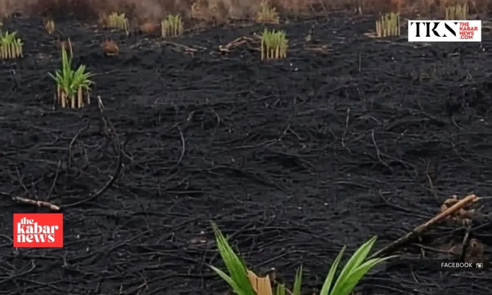
PONTIANAK, thekabarnews.com—The West Kalimantan chapter of the Indonesian Forum for the Environment (WALHI) has reported hotspot distributions across 166 palm oil and forestry permit areas during the province’s 2026 forest and land fire (karhutla) crisis.
WALHI said its analysis from January to August, using Nusantara Atlas data, found hotspots in 115 oil palm permit areas and 51 forest utilization business permit areas (PBPH).
The environmental group separately recorded at least 6,910 high-confidence hotspots across West Kalimantan’s 14 regencies and cities during August.
“We recorded at least 6,910 high-confidence hotspots spread across 14 regencies and cities during August 2026,” WALHI West Kalimantan advocacy and campaign representative Indra Syahnanda said in Pontianak on Wednesday, September 2.
WALHI also identified indicative burned areas inside 14 PBPH concessions. Its figures total approximately 2,353 hectares:
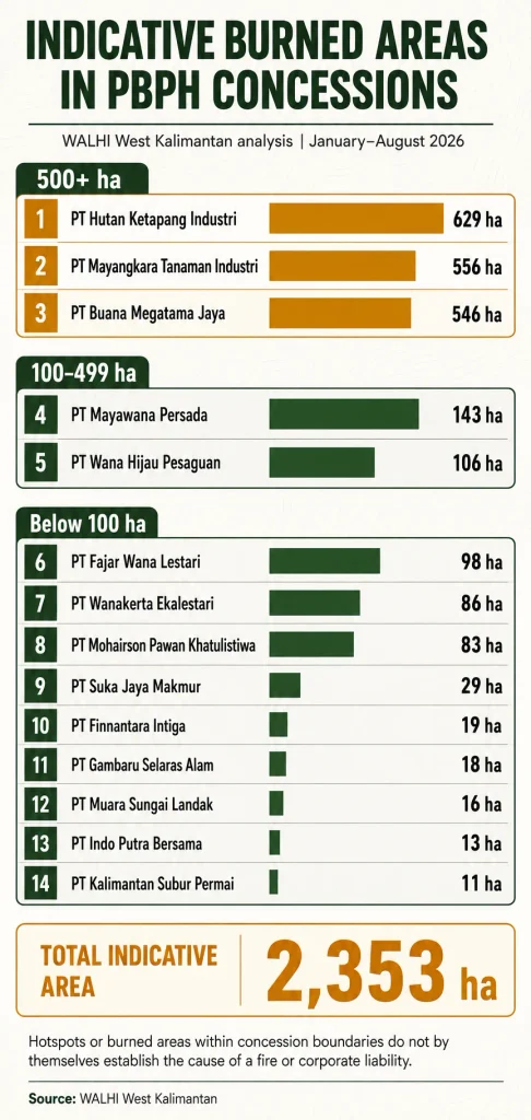
The three largest estimates involved PT Hutan Ketapang Industri, PT Mayangkara Tanaman Industri and PT Buana Megatama Jaya.
WALHI said four of the 14 concessions had experienced recurring fires, although authorities must verify the periods, boundaries and causes independently.
“Our analysis has shown 14 concessions with burned areas, including some that have burned repeatedly. The government must be prepared to revoke the permits of concessions with recurring fires,” Indra said.
A hotspot is a thermal anomaly detected by satellites. It does not, by itself, prove that a fire occurred at the precise point, identify who ignited it or establish corporate negligence. Cloud cover can also affect satellite detection, according to the BMKG.
Hotspots or burned land within a concession do not automatically establish that the permit holder caused the fire or committed an offense.
Investigators must examine ground evidence, fire origins and compliance with prevention duties before assigning legal responsibility.
The Forestry Ministry has nevertheless intensified administrative enforcement.
On August 25, it announced sanctions against six PBPH holders in three Kalimantan provinces after inspections found 1,511.55 hectares of burned land.
The measures included restoration orders and one permit suspension, according to the ministry’s official statement.
Forestry Minister Raja Juli Antoni later announced permit suspensions for five West Kalimantan companies on September 3.
He said authorities could pursue criminal proceedings if investigators found evidence of an offense. ANTARA reported that two companies named in that action also appeared in WALHI’s dataset.
The ownership descriptions circulated with the 14-company list require separate verification. For example, Sumitomo Forestry says PT Mayangkara Tanaman Industri became its wholly owned subsidiary in July 2021. The source material reviewed for this report did not include responses from the 14 companies.




No Comment! Be the first one.