



Hazardous haze chokes Kalimantan as fires spread
Thekabarnews.com—Thick smoke from expanding forest and land fires (Karhutla) has covered several areas of Kalimantan. As a result, visibility has been reduced and residents face dangerous...

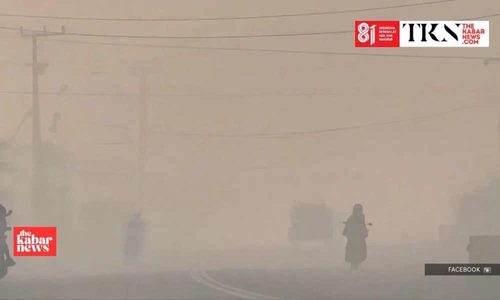
Thekabarnews.com—Thick smoke from expanding forest and land fires (Karhutla) has covered several areas of Kalimantan. As a result, visibility has been reduced and residents face dangerous concentrations of fine particulate pollution during Indonesia’s peak dry season.
The Meteorology, Climatology and Geophysics Agency (BMKG) recorded a PM2.5 concentration of 389.4 micrograms per cubic meter in Banjarbaru, South Kalimantan, at 7 a.m. local time on Wednesday, August 19. In response, BMKG classified the reading as hazardous.
Circulating footage appeared to show dense haze in Sungai Tabuk, Banjarmasin, Banjarbaru, Palangka Raya and other locations. The precise visibility and fire conditions differed between locations and changed as winds moved the smoke.
Air-quality readings improved significantly in Banjarbaru by Thursday afternoon. The BMKG monitoring station recorded PM2.5 at 18.2 micrograms per cubic meter at 4 p.m. WIB, or 5 p.m. in Banjarbaru, on August 20. BMKG placed the reading in the moderate category.
Conditions remained worse in Central Kalimantan. At the same observation time, BMKG recorded PM2.5 at 79.5 micrograms per cubic meter in Palangka Raya. This placed the city’s air in the unhealthy category.
The large difference between readings on August 19 and 20 illustrates how smoke concentration can change rapidly with wind, rainfall, fire intensity and the time of measurement.
A lower hourly reading does not necessarily mean that authorities have extinguished surrounding fires. In addition, it does not mean they have eliminated the risk of renewed haze.
BMKG said a strong El Niño and a tendency toward a positive Indian Ocean dipole had reduced rainfall across much of Indonesia.
By late July, 73.8 percent of the country’s seasonal zones had entered the dry season. Meanwhile, 76.3 percent recorded below-normal rainfall.
The BMKG’s monitoring found the Niño 3.4 sea-surface temperature anomaly had reached a level indicating a strong El Niño.
BMKG warned that the climate pattern could prolong dry conditions and increase the risk of forest and peatland fires. This is particularly true across Kalimantan and Sumatra.
El Niño does not ignite fires directly. However, it dries vegetation and peat, allowing fires started by human activity—including land clearing, rubbish burning and discarded cigarettes—to spread faster. These fires then become harder to extinguish.
The Forestry Ministry reported that fires burned about 202,004 hectares nationwide between January and July 2026.
Around 57 percent of the affected area was inside designated forest zones. 43 percent was on other land, according to the ministry’s official figures.
Independent monitoring platform Nusantara Atlas estimated a larger total of approximately 285,914 hectares. The figures differ because government and independent systems use different satellite imagery, detection methods and verification schedules.
Authorities are responding through ground firefighting, water-bombing operations, weather modification, hotspot patrols and peatland rewetting.
The Forestry Ministry has also reported administrative action involving 42 forestry permit holders and nine criminal cases. In those cases, investigators named suspects in four cases.
The Health Ministry advises residents in smoke-affected areas to reduce outdoor activity, close doors and windows, wear an effective mask when going outside and seek medical care if they experience breathing difficulties.
Children, women in pregnancy, older people and those with heart or respiratory conditions face greater health risks.






No Comment! Be the first one.