



BNPB maps 44 burned areas in South Sumatra
PALEMBANG, thekabarnews.com—The National Disaster Mitigation Agency (BNPB) has identified 44 burned forest-conversion and plantation areas in South Sumatra. This has sparked calls for a formal...

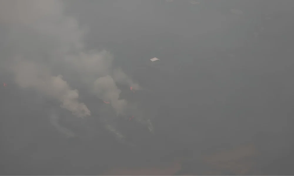
PALEMBANG, thekabarnews.com—The National Disaster Mitigation Agency (BNPB) has identified 44 burned forest-conversion and plantation areas in South Sumatra. This has sparked calls for a formal investigation into possible planned land clearing.
BNPB head Lt. Gen. Kristomei Sianturi disclosed the findings during an emergency coordination meeting in Palembang on Sunday, Oct. 18. The meeting was part of his first official field agenda after taking office. Additionally, it focused on operational gaps in the province’s forest and land fire response.
South Sumatra Governor Herman Deru and Meteorology, Climatology and Geophysics Agency (BMKG) head Teuku Faisal Fathani attended the meeting. Regional disaster officials and representatives of agencies responsible for peatland management were also present.
BNPB said it produced the findings by matching its spatial mapping with land data from the Agrarian and Spatial Planning Ministry/National Land Agency (BPN). The 44 locations include oil palm areas, industrial forest plantations, forest-management units and protected forests.
Read also: BNPB and BMKG strengthen data-driven disaster response
Many fire locations appeared near the boundaries of land-use permits, according to BNPB. The pattern raised suspicions that some fires could be connected to land clearing or expansion.
However, the spatial findings do not by themselves establish criminal responsibility. Investigators must determine the causes and identify any responsible parties.
BNPB consequently urged law enforcement agencies to investigate individuals or companies suspected of setting fires.
“It is pointless for us to work hard if the firefighting efforts are not synchronized. One person tries to extinguish the fire while another sets it again, so it returns,” Kristomei said in a statement published by BNPB.
Read also: Prabowo orders stronger response to Indonesia fires
Kristomei called for joint operational posts to be organized around clusters of active fire locations. Each post should have a clearly appointed commander, a defined operational area and verified records of personnel and equipment deployed.
He also ordered periodic assessments. These would determine whether thousands of personnel and aerial assets were actually reducing the number of hotspots and the burned area.
BNPB wants field reports to reflect the number of personnel physically present. This is partly to ensure their safety and access to medical monitoring after prolonged smoke exposure.
The agency is also evaluating water bombing and weather-modification operations using sodium chloride or dry ice. Kristomei said authorities must measure their effectiveness scientifically before expanding their use. This is particularly important because aerial operations carry substantial costs and depend on atmospheric conditions.
Read also: KPK questions 14 in BNPB procurement corruption probe
BMKG confirmed that authorities used weather data and atmospheric analysis to guide ground operations, water bombing and cloud-seeding decisions. The agency said the Oct. 18 meeting evaluated hotspots and strengthened operational command in priority areas.
Peatlands remain a central concern because fires can continue below the surface after visible flames disappear. Therefore, BNPB asked the peatland authorities to develop longer-term measures. These include restoring or improving canals to retain moisture in deeper peat layers.
South Sumatra had already classified 12 regencies and cities as priority fire-risk areas for 2026. They include Ogan Komering Ilir, Banyuasin and Musi Banyuasin.
BMKG previously reported that the province’s burned area declined from around 15,422 hectares in 2024 to 5,939 hectares in 2025. However, drier conditions and El Niño continued to increase the 2026 risk.
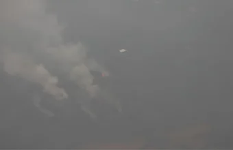
After the meeting, Kristomei and Fathani inspected parts of South Sumatra by helicopter, including Ogan Komering Ilir. They still observed smoke and active fires. This reinforced the need to connect field deployment, aerial support and law enforcement under a single operational plan.

No Comment! Be the first one.