



Winds keep wildfire smoke over Pontianak, BPBD says
PONTIANAK, thekabarnews.com—Smoke from land and forest fires (karhutla) continued to blanket Pontianak on Monday, Oct. 5, despite recent rainfall and a decline in local hotspots, as slow-moving winds...

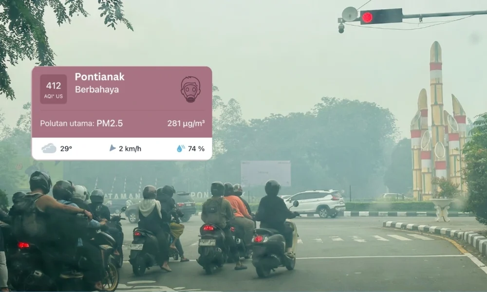
PONTIANAK, thekabarnews.com—Smoke from land and forest fires (karhutla) continued to blanket Pontianak on Monday, Oct. 5, despite recent rainfall and a decline in local hotspots, as slow-moving winds carried pollution toward the provincial capital.
Acting West Kalimantan Disaster Mitigation Agency (BPBD) head Ridwan said monitoring data showed that prevailing winds were directing smoke toward West Kalimantan, including Pontianak.
“Based on the data we have received and several applications we use, the wind is still moving toward West Kalimantan, specifically the Pontianak area,” Ridwan told reporters at the BPBD’s office on Monday.
BPBD said satellite monitoring had detected no hotspots in Pontianak, neighboring Kubu Raya and Mempawah during the previous week. However, fires were still burning in other parts of West Kalimantan, particularly Ketapang regency, although officials said their scale had decreased.
Data received from the Meteorology, Climatology and Geophysics Agency (BMKG) showed 24 high-confidence hotspots across West Kalimantan as of 11:59 p.m. on Oct. 4. Authorities detected most of them in Ketapang. In fact, many were in the Kendawangan area, according to a report on BPBD’s latest briefing.
Ridwan said smoke could also travel from fires elsewhere on Kalimantan, where several Indonesian provinces have reported land and forest fires. He cautioned against assigning responsibility to one region without detailed atmospheric analysis.
“We are not blaming or pointing fingers at other regions. Almost all of Kalimantan is experiencing fires, and the winds are still moving toward West Kalimantan,” he said.
Pontianak’s location near the equator also affects how quickly the haze disperses. Ridwan said slower air movement around the equatorial zone could allow smoke to remain over the city even after rain.
“The movement of air is relatively slow in Pontianak because it lies in the equatorial region. That is why the haze cannot disappear immediately, even after rainfall,” he said.
Air-quality data indicated that the haze posed a serious public-health risk. At 3 p.m. on Monday, the Environment Ministry’s monitoring station in Southeast Pontianak recorded an Air Pollution Standard Index (ISPU) of 328 for PM10 and 289 for PM2.5.
The ministry classifies an ISPU reading above 300 as hazardous. Its station recorded a 24-hour average PM2.5 concentration of 239 micrograms per cubic meter in Southeast Pontianak. This figure was according to the official ispu.kemenlh.go.id.
The readings from the government monitoring station use Indonesia’s ISPU scale. Therefore, they should not be directly compared with figures from private platforms that apply the US AQI system.
The Health Ministry has advised residents in areas affected by wildfire smoke to reduce outdoor activity and wear masks when air quality deteriorates. Children, women in pregnancy, older adults and people with asthma or chronic lung conditions face greater risks from PM2.5 exposure.
BPBD said firefighting operations and weather modification would continue, with Ketapang remaining a priority. Rain could help with land wetting, but the haze may persist until fire activity declines further and wind patterns change.




No Comment! Be the first one.